CCM 
|
CCM 
|

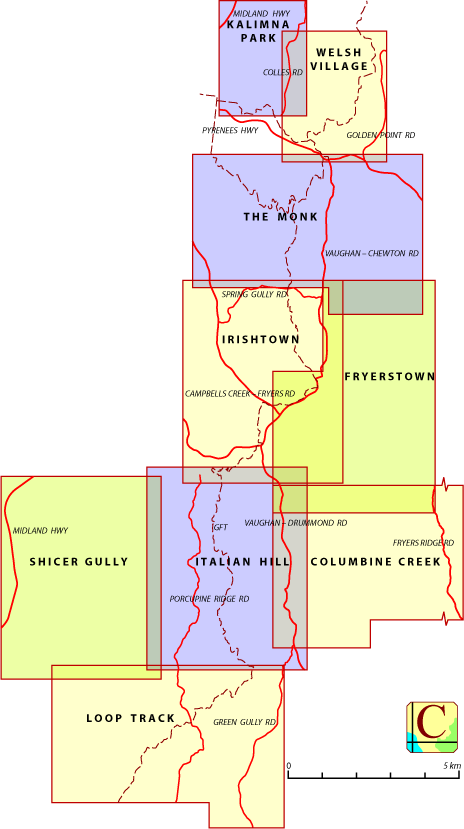
The Castlemaine Diggings National Heritage Park, CDNHP, stretches some 25 kilometres north to south in Central Victoria, Australia. CCM provides nine topographical maps that cover the bulk of the park. The individual map pages can be accessed:
There are numerous mine shafts and other hazardous structures within the Castlemaine Diggings National Heritage Park. Travellers should take care.
Each map can be downloaded as a PDF file. The intended print size for each map is A3.
Information on the use of other files supplied by CCM can be found via the Appendix panel of the header menu.
Maps available on this site include sections of The Great Dividing Trail and The Goldfields Track. The CCM maps, however, are intended to be broad coverage bushwalking guides and are not specifically directed to those two major tracks. Comprehensive information for travellers intending to use those tracks is available from the Great Dividing Trail and Goldfields Track websites.
Some of the groups that CCM has interacted (positively!) with, in preparing the Castlemaine Diggings National Heritage Park maps, are:
The principal resource is simply boot leather; if a road or track within the CDNHP (and many of those outside the CDNHP) is indicated on a map then CCM has walked it. Other resources that have been used in the construction of the maps are: