CCM 
|
|
Caveat:
A map is a graphical representation of a geographical actuality. However, though some maps are more representative than others, no map is absolutely correct. The maps on this site are not exempt from this rule. |

CCM 
|
|
Caveat:
A map is a graphical representation of a geographical actuality. However, though some maps are more representative than others, no map is absolutely correct. The maps on this site are not exempt from this rule. |


Each CCM map is available in PDF format. To match the nominal scale the map should be printed at "Scale none" or "Scale Custom 100%". If there is a cropping problem (not the case with the printers at Castlemaine and Kangaroo Flat libraries), print at "fit to printer margins".
KMZ files are georeferencd. A KMZ file will open in Google Earth Pro.
Download the CCM file from this website and then in Google Earth Desktop select File –> Open and pull down the menu in bottom-right of the Open dialogue box and select Google Earth
(the first menu item) and follow the normal file selection procedure.
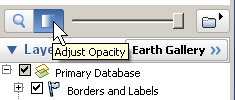
The opacity of a map image can be controlled with the slider at the base of the "Places" box in the side bar. Map features can be readily checked against satellite imagery with the opacity control.
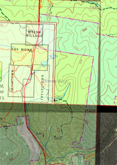
KMZ maps may be overlayed one on another and alignment of features checked by use of the transparency slider. See snips from Google Earth to the right.

When a KMZ file with a map image is loaded into Google Earth Pro then the Google Earth tools, particularly for distance measurement, can be used on the data provided on the map image. Google Earth Pro for desktop provides additional features including an area calculation tool.
Google Earth Pro can also be used for documentation. Notation can be overlaid on displayed data and saved as a KMZ file. The CCM file Central Victorian Outlines is a KMZ file that was constructed this way.
Google Earth on mobile will load KMZ files for display. Download the KMZ file and open it in Google Earth on your mobile device.
Garmin "map capable" GNSS units will load KMZ files for map display.
Please refer to the about OziExplorer page.
PDF files may be georeferenced, then they are called geoPDF files. CCM provides geoPDF files along with plain PDF files which are perferred for printing.
There is a free version of the Avenza app available and it is an excellent entry to the use of maps on mobile devices. It can load the geoPDF files provided by CCM as well as "millions" of other maps. For mobile devices with GNSS "onboard", after the initial downloading of the appropriate map, the Avenza app will function without internet connection. Downloaded maps may be stored in the download folder on the mobile device for later access.
Please refer to the about POI files and GNSS units page.